Mid-Atlantic Ridge
The Mid-Atlantic Ridge is an exceptionally extensive system of mid-ocean ridges stretching across the Atlantic Ocean where lithospheric plates move away from each other and new oceanic crust is formed. It is sometimes referred to as the longest volcanic system on Earth, extending more than 16,000 km.1
It is precisely in such areas that the Earth’s crust is thinnest and most directly connected to the processes occurring in the Earth’s mantle. As a result, this part of the Earth may react more sensitively to changes in magma supply, heat flow, or the dynamics of mantle currents.
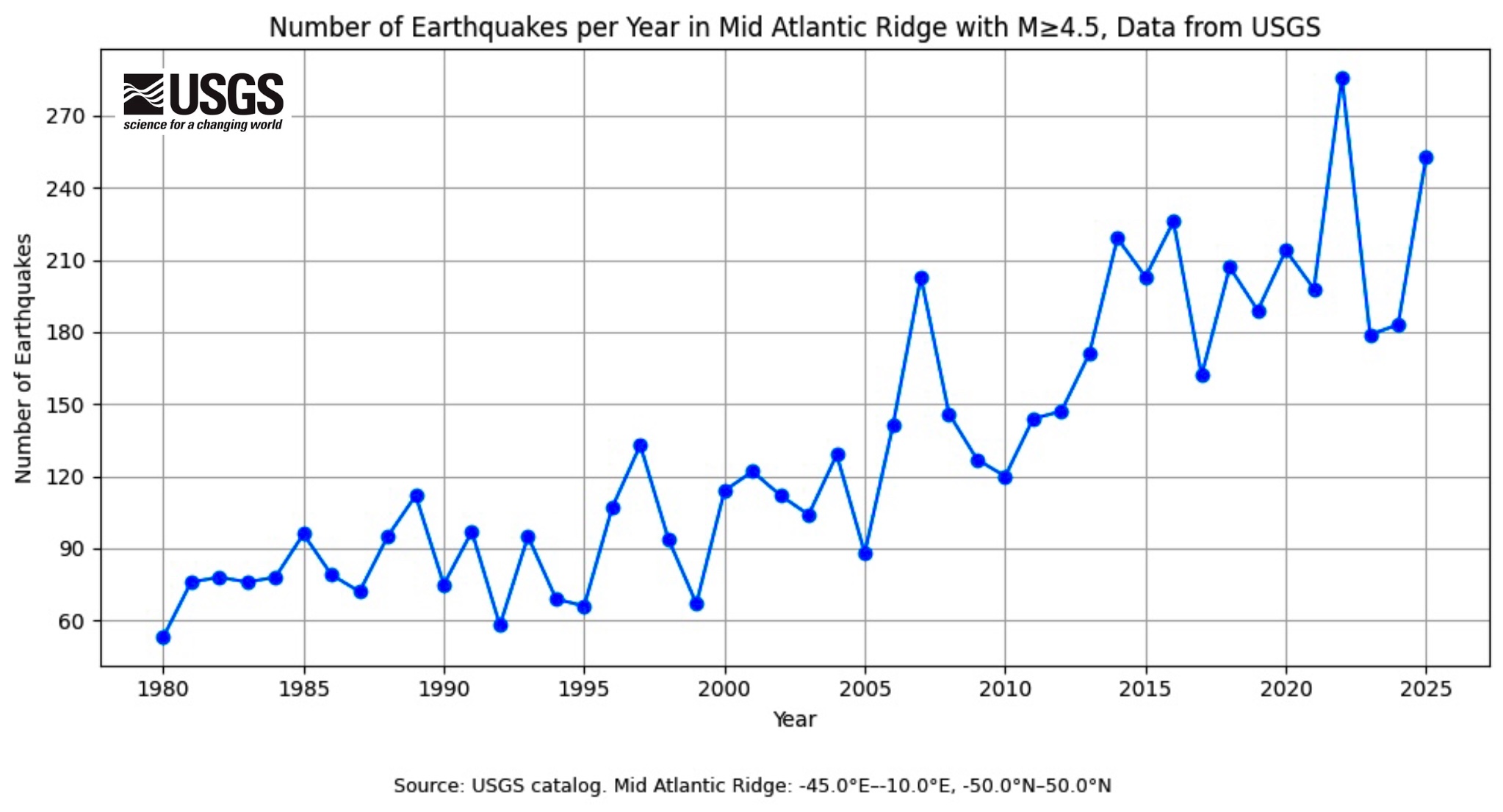
Fig. 1: Number of earthquakes with M ≥ 4.5 on the Mid-Atlantic Ridge, data source: USGS https://earthquake.usgs.gov/earthquakes/search/
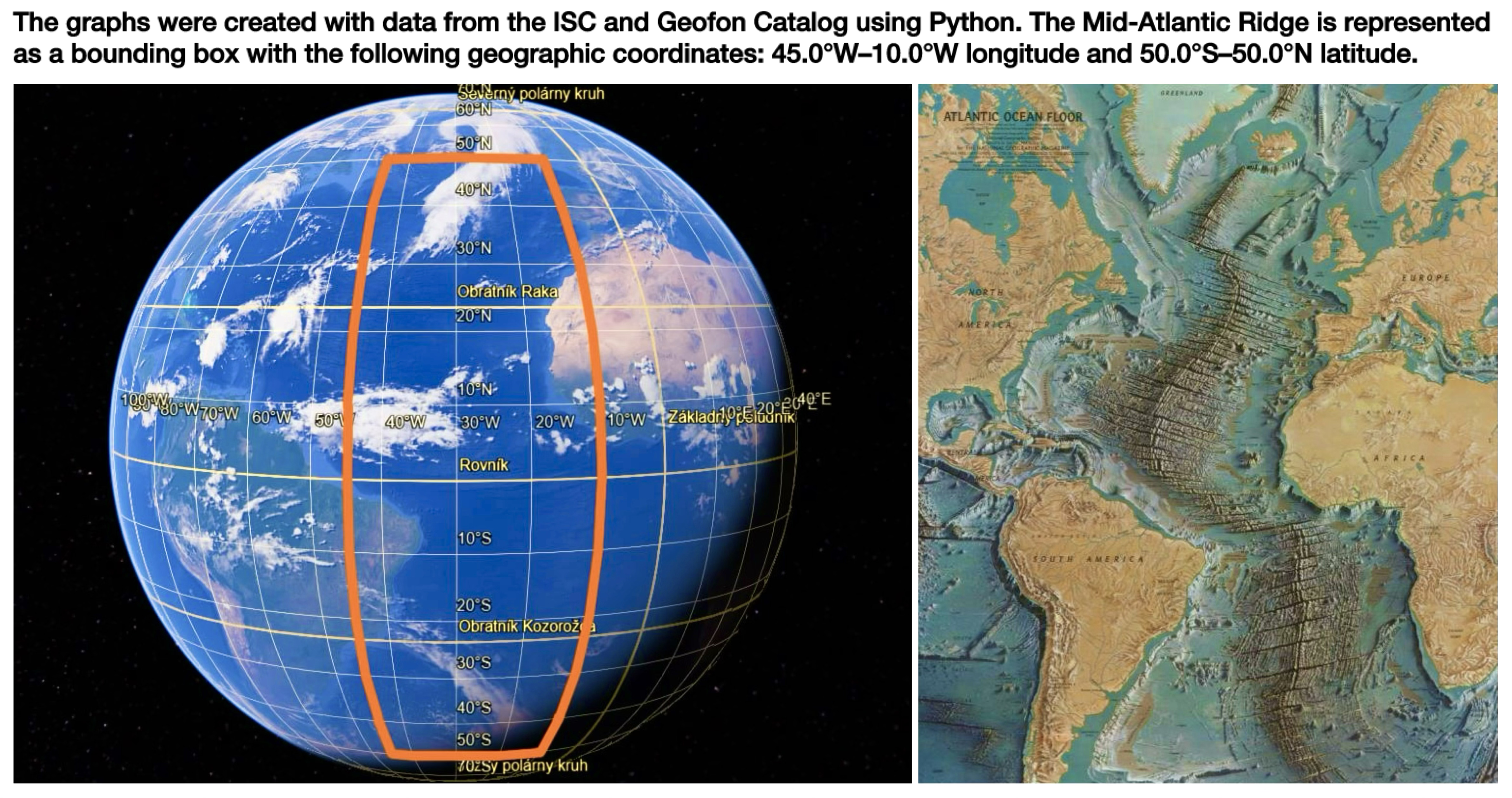
Fig. 2: Analyzed zone of the Mid-Atlantic Ridge region, sources: Google Earth, own modification (left), https://www.researchgate.net/figure/Map-of-the-mid-Atlantic-ridge-Heezen-B-Tharp-M-1968_fig3_341592959 (right)
The graph in Figure 1 shows a long-term increase in the number of recorded earthquakes, particularly after the year 2000. Significant year-to-year fluctuations indicate real episodes of increased activity. The most pronounced increases around 2007 and again in 2014, 2016, 2022, and 2025 correspond temporally to periods when stronger earthquakes (M 6–M 7) and subsequent aftershock sequences were documented along various segments of the Mid-Atlantic Ridge. In such cases, the annual number of events increases not because of a single isolated event but due to sequences of shocks distributed in time and space. Figure 2 shows the boundaries of the analyzed zone on the map.
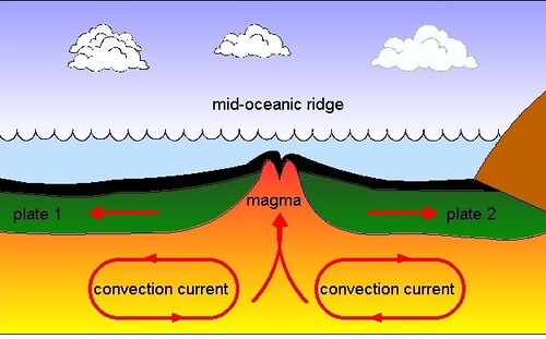
Fig. 3: Left: schematic of a mid-ocean ridge where magma rises, cools, and forms new crust, source: https://www.flickr.com/photos/114042825@N07/11877403915,
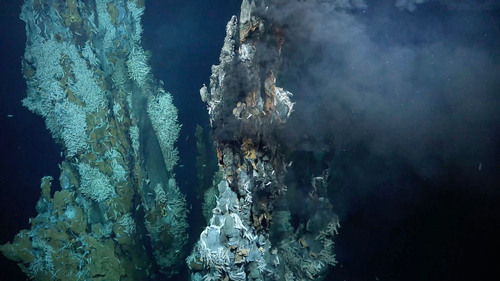
Fig. 4: high-temperature hydrothermal vent field discovered on the submarine mountain Puy des Folles on the Mid-Atlantic Ridge at a depth of approximately 2,000 meters, source: https://oceanexplorer.noaa.gov/expedition/23lost-cities/
Reference:
UNESCO World Heritage Centre (2017) Mid-Atlantic Ridge. Available at: https://whc.unesco.org/en/tentativelists/6231/ (Accessed: March 16, 2026).